Welcome to Lawrence Lau's homepage
|
Personal Info GNSS Research
Research › |
|
NEWS
|
|
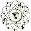
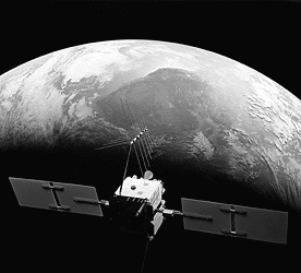
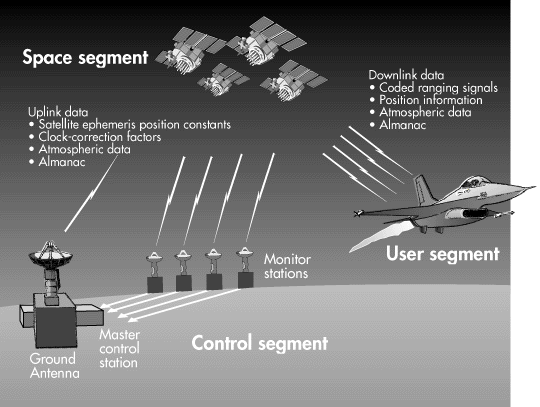
Galileo Constellation GPS Constellation GPS GPS stand for Global Positioning System. It contains 24 operational satellites in Military Full Operational Capability (FOC). FOC is achieved when 24 operational satellites are operating in their assigned orbits and the constellation has been tested for operational military performance.
It was first designed for military use. The original objectives of GPS given by Wooden (1985) as: "The Navstar Global Positioning System (GPS) is an all-weather,space-based navigation system under development by the Department of Defense (DoD) to satisfy the requirements for the military forces to accurately determine their position, velocity, and time in a common reference system, anywhere on or near the Earth on a continuous basis."
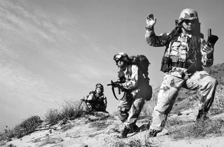
More than 9,000 GPS receivers were used in Operation Desert Storm (Gulf War) However, GPS is available to civilian user now. GPS is a ranging system from known positions of satellites in space to unknown positions on land, sea, in air and space. It determines a position in real-time by code measurement. However, the real-time accuracy of the position is limited by DoD. The available accuracy to civilian user is in meter level.
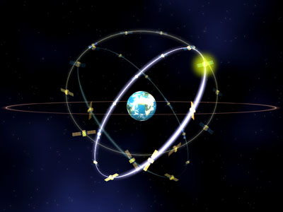
GPS becomes a popular tool in high accuracy required Land Surveying and Geodesy. High accuracy positioning in land surveying and geodesy can be achieved by carrier phase measurement and post-processing. In general, millimeter or better accuracy can be achieved in Static Relative (or Differential) GPS. Real-time positioning in land surveying was available since 1995. This method is called Real-Time Kinematic (RTK). The RTK accuracy is about 30cm. European GNSS - Galileo The European GNSS, named Galileo, is being developed to provide four carrier frequencies and its Full Operational Capability (FOC) is scheduled to be in 2008, but more likely in 2010. Galileo constellation consists of 30 satellites (27 operational plus 3 in-orbit spares) in 3 orbital planes with 120º apart. The inclination of the orbital planes is 56º, the orbital radius is 29,994 km, and the satellite orbiting period is about 14.4 hours. The illustration of Galileo constellation is shown on top of this page. Galileo signals will be available to users in four categories, they are Open Service (OS), Safety-of-Life (SoL) service, Commercial Service (CS), and Public Regulated Service (PRS). PhD research Thesis title: Phase Multipath Modelling and Mitigation in Multiple Frequency GPS and Galileo Positioning. Part of the investiation into multipath mitigation using multiple frequency data is described here. Abstract of thesis: Multipath is the main error source in short- to medium-baseline GNSS (Global Navigation Satellite System) relative positioning. So, in order to achieve the highest possible accuracy, multipath errors must be modelled and/or mitigated. A new era in GNSS positioning is on the horizon. GPS modernisation is being undertaken, which will provide an unencrypted civil signal (L2C) on the L2 frequency and the signal power of the L2 signal will be increased. Also an additional signal, the so-called L5, will be available on GPS Block IIF satellites scheduled for launch beginning in mid-2006. Furthermore, the European GNSS, named Galileo, is being developed to provide four carrier frequencies and its Full Operational Capability (FOC) is scheduled to be in 2008, but more likely in 2010. This study identifies and models the factors causing phase multipath errors and investigates some possible phase multipath mitigation techniques using the multiple frequency data that modernised GPS and Galileo will offer. A GNSS data simulator has been developed to generate multipath contaminated data using a phase multipath model based on ray tracing. All known geometrical and physical factors have been taken into account and are described in detail. The model has been validated with real data collected in two experiments with reflectors of different materials. A GNSS data processor has been developed for this validation and for subsequent analyses. The results show good agreement (i.e. similar amplitude and frequency) with real multipath from a steel panel (planar reflector) and fairly good agreement (i.e. similar amplitude with slight different frequency) with real multipath from a lake (dynamic irregular reflector). They show that the multipath model has the potential to correct phase multipath errors in cases where the exact geometry of the reflection process and the nature of the reflector are known. Some of the characteristics of phase multipath and the sensitivities of simulated GNSS measurements to the factors causing multipath are investigated and described. Multipath mitigation through averaging based on the least squares process and standard outlier detection technique using multiple frequency GPS, Galileo, and integrated GPS and Galileo data have been investigated. Since multiple frequency GPS and Galileo data are not yet available, all data has been generated by the GNSS data simulator described in the foregoing. It was found that standard outlier detection techniques were not sufficiently robust to tackle the frequency-dependent multipath errors because they could not handle the worst case scenario when multiple frequency multipath errors from a particular satellite were all in-phase. Therefore a cocktail multiple outlier detection algorithm has been proposed and tested. Results show that a combination of more satellites, more frequencies and the cocktail multiple outlier algorithm can substantially mitigate multipath errors and so improve positioning accuracy.For details, see my PhD Thesis (upon request by email, free or unknown email account is not accepted). ....... Current postdoctoral research Seamless Positioning in All Conditions and Environments (SPACE) SPACE (Seamless Positioning in All Conditions and Environments) is an EPSRC-funded Pinpoint Faraday ( http://www.pinpoint-faraday.org.uk/ ) flagship collaborative research project currently being undertaken by a consortium of twelve UK university and industrial groups. The university groups are the CAA Institute of Satellite Navigation at the University of Leeds, the Department of Civil and Environmental Engineering at Imperial College London, the Department of Geomatic Engineering at University College London (UCL), and the Institute of Engineering Surveying and Space Geodesy at University of Nottingham, and the industrial partners are Astrium, BAE Systems, The Civil Aviation Authority, Leica Geosystems (UK), NSL, Ordnance Survey, Qinetiq and Thales. The primary aim of SPACE is to undertake the basic research needed to build a prototype GNSS-based positioning system that can deliver cm-level accuracy positioning everywhere and at all times. The main component research thrusts are multipath modelling and mitigation, quality control and assessment, measurement modelling and integration, and GNSS sensor design. The key output from SPACE will be the fully tested design of a prototype plug and play integrated positioning system that can be used as a test bed for current and future positioning components and algorithms. ....... London Centre for GNSS Research (LCGR) Question(s) about GNSS and my research, please e-mail to :
|
 GNSS Research
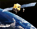
|
Research - GNSS Data & Info Download - GNSS Links - Publications- Contact
Me Last modification: 1st September 2005 |